Exploring Dehradun: Where Is Dehradun in India Map?
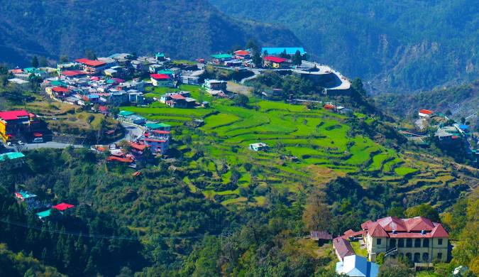
Dehradun, a city that lies in the heart of Uttarakhand, captures the essence of both nature and history. When someone asks, “Where is Dehradun in India map?” they’re looking at a location nestled between the Shivalik Hills in the south and the Himalayas in the north. This city serves as the capital of Uttarakhand and offers a unique blend of culture, education, and natural beauty.
Dehradun’s location makes it a perfect gateway to several popular hill stations like Mussoorie and pilgrimage spots like Rishikesh and Haridwar. The city’s position on the India map places it in the Doon Valley, providing it with a climate that stays pleasant throughout the year. This strategic location has attracted settlers, rulers, and travelers for centuries.
The history of Dehradun stretches back to ancient times, with mentions in texts like the Ramayana and Mahabharata. The city’s name originates from “Dera” meaning camp and “Dun” meaning valley. Guru Ram Rai, the eldest son of the seventh Sikh Guru, Guru Har Rai, established his “dera” or camp here in the 17th century, which eventually grew into the modern city we see today. His settlement attracted people from various regions, giving Dehradun a rich cultural tapestry.
Dehradun’s growth as a city accelerated under British rule in the 18th and 19th centuries. The British recognized the region’s strategic importance and developed it as a center of education and administration. Prestigious institutions like the Doon School, Welham Girls’ School, and the Indian Military Academy were established during this period, making Dehradun a prominent educational hub.
The architecture of Dehradun reflects its diverse history. Colonial-era buildings like the Forest Research Institute (FRI) stand as grand examples of Greco-Roman architecture. The FRI, with its massive columns and expansive grounds, attracts not only students and researchers but also tourists who appreciate its majestic design.
Dehradun also boasts religious sites that highlight its spiritual significance. The Tapkeshwar Temple, dedicated to Lord Shiva, lies inside a natural cave and attracts thousands of devotees every year. The constant flow of water over the Shiva Linga in the temple adds to its mystical charm. Additionally, the Mindrolling Monastery, one of the largest Buddhist centers in India, reflects the city’s cultural diversity. Its impressive stupa and peaceful surroundings offer a serene retreat for visitors.
Modern-day Dehradun has grown into a bustling city while maintaining its connection to nature. Rajaji National Park, located on the outskirts, offers a glimpse of the region’s rich biodiversity, with opportunities to spot elephants, tigers, and leopards. The Malsi Deer Park and Robber’s Cave provide more spots for nature lovers to explore.
In Dehradun, the streets buzz with life, offering a mix of traditional markets and modern shopping centers. Paltan Bazaar and Tibetan Market remain popular spots for buying local handicrafts, woolen clothes, and souvenirs. The city’s food scene blends local Garhwali cuisine with influences from Punjabi, Tibetan, and North Indian flavors. Street food enthusiasts enjoy savoring dishes like Aloo ke Gutke, Bal Mithai, and piping hot momos.
So, where is Dehradun on the India map? It sits as a jewel in the foothills of the Himalayas, offering visitors a perfect mix of natural beauty, historical depth, and cultural richness. This city invites you to explore its past, enjoy its present, and dream about its future. Whether you’re a traveler, a student, or someone seeking a peaceful retreat, Dehradun provides a destination that’s easy to find on the map and hard to forget in your heart.

